
Crop Spraying & Agriculture

We offer
High-Precision Crop Spraying
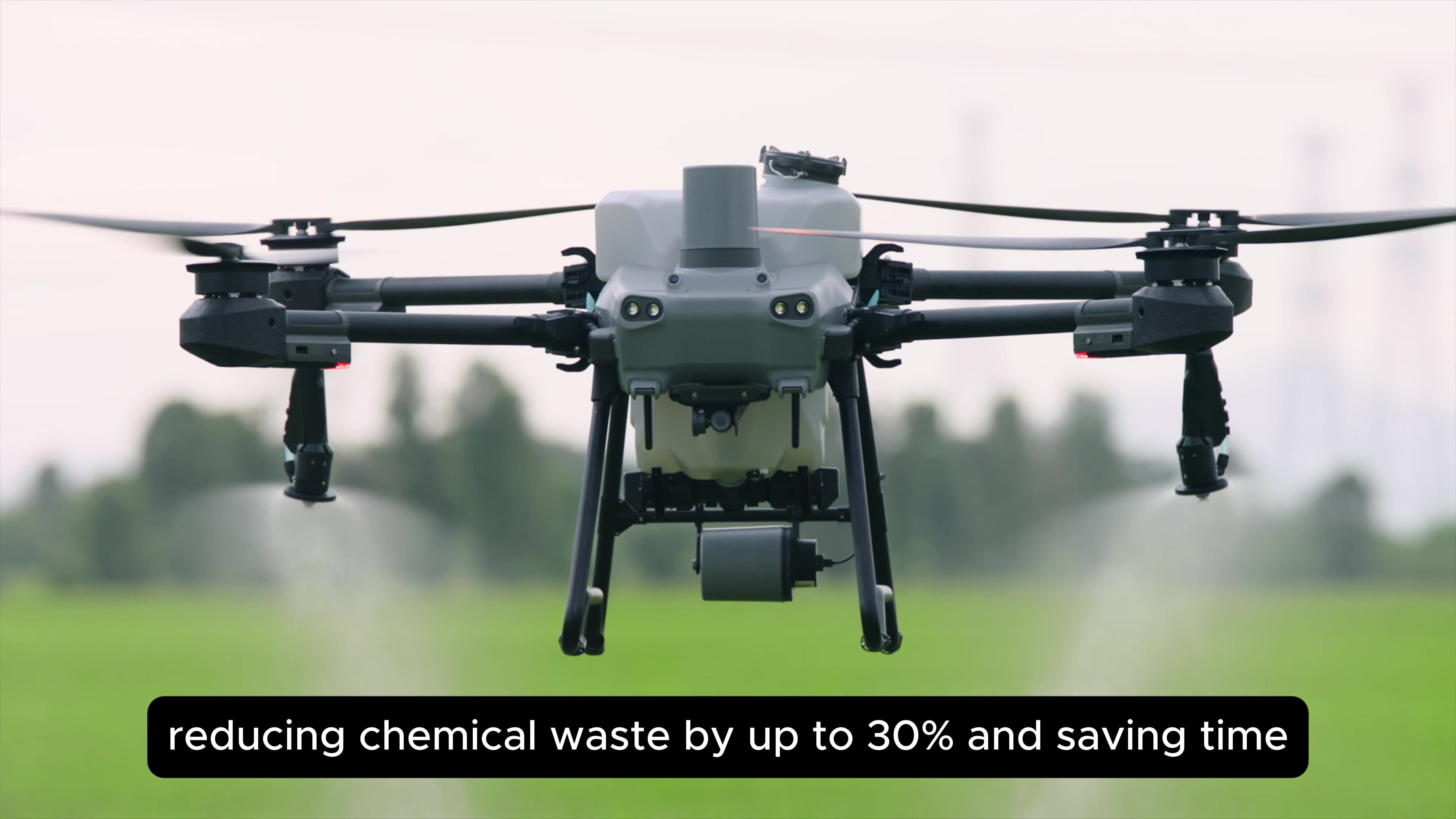
Using the DJI Agras T50, we deliver targeted spraying with uniform droplet coverage, saving time, reducing labor, and minimizing chemical waste. Perfect for herbicides, pesticides, fungicides, and foliar feeding.
Crop Health Monitoring
With the DJI Mavic 3 Multispectral, we detect crop stress, pest infestation, nutrient deficiencies, and irrigation issues—enabling farmers to take action before it’s too late.
Seed and Fertilizer Spreading
Broadcast seeds or granular fertilizer over large fields using customizable mission plans for even and efficient distribution.
Aerial Scouting and Zone Management
Identify problematic zones within fields through NDVI and NDRE data, then treat them surgically—saving you time and product.
Field Mapping & Surveying
Generate 2D orthomosaic maps, 3D terrain models, and crop field outlines for land-use planning, soil sampling, and irrigation design.
Farm Infrastructure Monitoring
Regular inspections of water lines, irrigation pivots, fencing, and storage facilities from the air—fast, safe, and effective.

Improved Operational Efficiency
Spray rate of up to 16L/min
Sprays Approximately 21 ha/hour
Aircraft: DJI M3 M
Data Acquisition
Centimeter-Level Positioning
High-Precision Data Collection
Crop Spraying Workflow

Field Mapping
Mission Planning
Software: DJI Terra
Data Processing
Real-Time Mapping
2D/3D Reconstruction
AI-Generated Flight Paths
Crop Spraying
Aircraft: AGRAS T50

Advantages of Drones in Agriculture
_edited.png)
Precision Application – Drones target exact zones, minimizing over-application of chemicals and fertilizer.
_edited.png)
Better Data for Decision-Making – Multispectral scans detect problems early, supporting yield-boosting actions.
_edited.png)
Reduced Labour Costs – Automating tasks like spraying and monitoring eliminates the need for large ground crews.
_edited.png)
Eco-Friendly Farming – Less chemical drift, lower water usage, and smarter treatment of only affected areas.
_edited.png)
Faster Coverage – Cover hundreds of hectares per day, far outperforming manual or tractor-based solutions.
_edited.png)
Access to Difficult Terrain – Reach marshy, rocky, or hilly areas easily without damaging soil or crops.
Vision Dynamics is an experienced drone survey company in agriculture that uses multispectral technology to pinpoint underperforming crops and deliver cost-effective, efficient data collection and analysis. Our mission is to empower farmers to reduce costs and increase yields by providing the vital insights needed for better decision-making.

Manned Aircraft vs Drones
Manned crop spraying is aimed at covering as much ground as possible. This assists the farmer in completing their fields as quickly as possible but also leads to higher chemical drift and higher usage of applicants. The applicant penetration is a lot lighter and often covers only the top third of the crop as the aircraft is flying higher and faster. For manned aircraft, the company needs to be supplied with large fields otherwise it is not finically viable to fly in and spray.
Drones can focus on smaller fields and the precision of spraying the applicant. Drones are able control the height and speed as well as many other parameters above the crop canopy which leads to consistent coverage and deeper penetration into the crop. Drones are able to cover every area of a field to leaf’s edge, leaving no plant untouched by applicant. Chemical drift is lower with drones and can spray fields that are closer to water and sensitive areas.
Get a Quote:
Ready to take your project to new heights? At Vision Dynamics, we're here to provide you with tailored solutions that meet your unique needs. Whether you're interested in aerial video and photography, ground video and photography, mapping and surveying, or photo and video editing, our team is dedicated to delivering excellence.


